Map Regression is useful for looking at the change of landscape through time, using maps – almost as a mode of time travel. Each of these maps show an area in the Bassetlaw District of North Nottinghamshire. It is apart of the Welbeck Estate and has had a change in use through time.
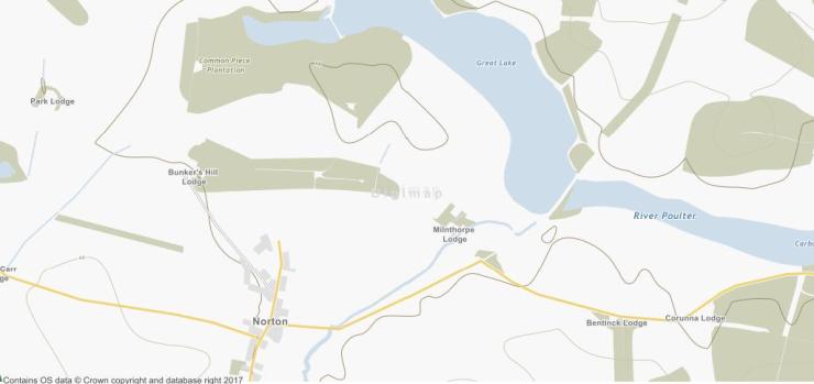
This is a modern map of the area at the south of the Welbeck Estate. Modern maps give a starting point for map regression and can give some clue’s as to what earlier maps might reveal. This could be ruins marked on the map – or in this case – place name’s (Bunker’s Hill Lodge). This map just gives a general idea of the landscape.
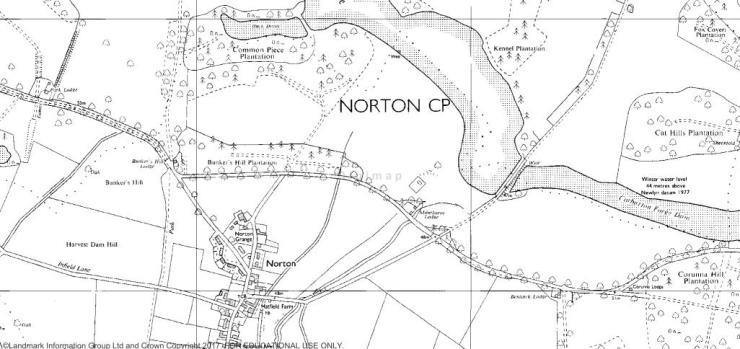
This map shows the same area in the 1990’s and gives some clues more about what the land was used for. There is more details marked on this map which are absent from the later map. It gives an idea of the layout of the village and the types of land coverage (trees ect). It also provides futher place names such as Bunkers Hill Plantation.
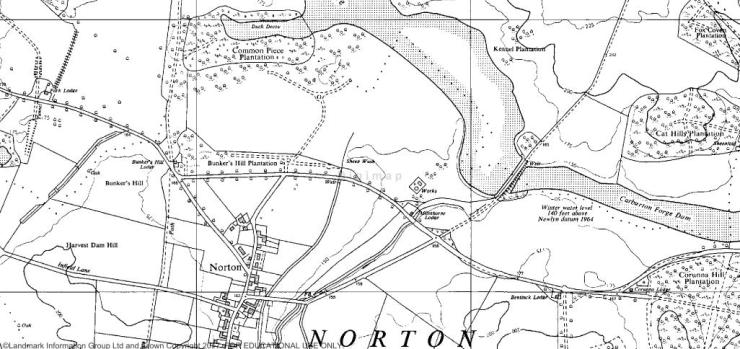
This is the 1960’s map showing the landscape north of Norton. It shows the village and it’s surroundings in a lot of detail, including the flooded water level in 1964. It also shows a dashed road north of Norton with roads that seemingly lead nowhere, though the remains of a roundabout can still be seen.
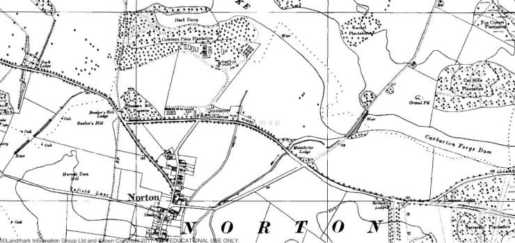
This is the 1950’s image of the land north of Norton. It shows – where in later maps there is just abandoned roads and place names – buildings and an enclosure. This is a prisoner of war camp that was used to re-educate German POW’s during the course of the second world war up to 1954.
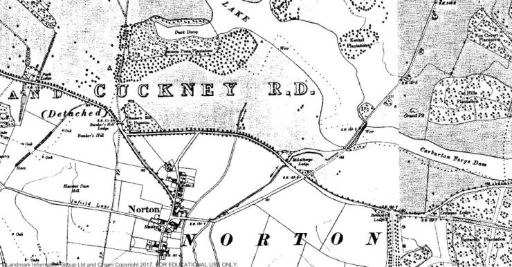
This final map is from the 1920’s and shows the site before it was occupied by a Prisoner of War Camp. It also shows the extent of the village of Norton and how the landscape has changed and adapted in the last Century.